BATTLE OF KANDAHAR +140 POST #2:
A short but sweet update to the battlefield itself. First are pics of multiple maps I have been pouring over and then the revamped tabletop.
Most important amongst all these maps is the big foldout from the British Army’s Intelligence Branch OFFICIAL HISTORY of the Second Afghan War. I got these photos courtesy of one my oldest and best friends in the world, James “Jimmy G.” Garzillo. I’ve known Jimmy G. for about 35 years and he’s been an active book collector specializing in military history for probably a decade before I met him. My heartfelt thanks to Jim and also his younger brother John, who is the one that managed to locate and retrieve the book from Jimmy’s vast collection. Thank you my Brooklyn brothers!
Map of the battle from “THE ROAD TO KABUL,
THE SECOND AFGHAN WAR, 1878-1880″ by Brian Robson:
Map of the battle from “BATTLE STORY – MAIWAND 1880” by Edmund Yorke:

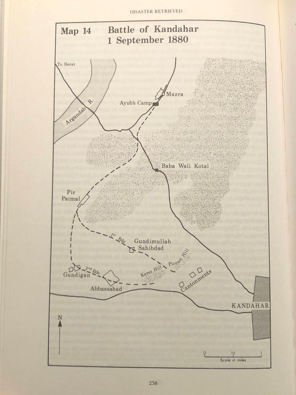
Map of the battle from “THE MARCH TO KANDAHAR” by Rodney Atwood:
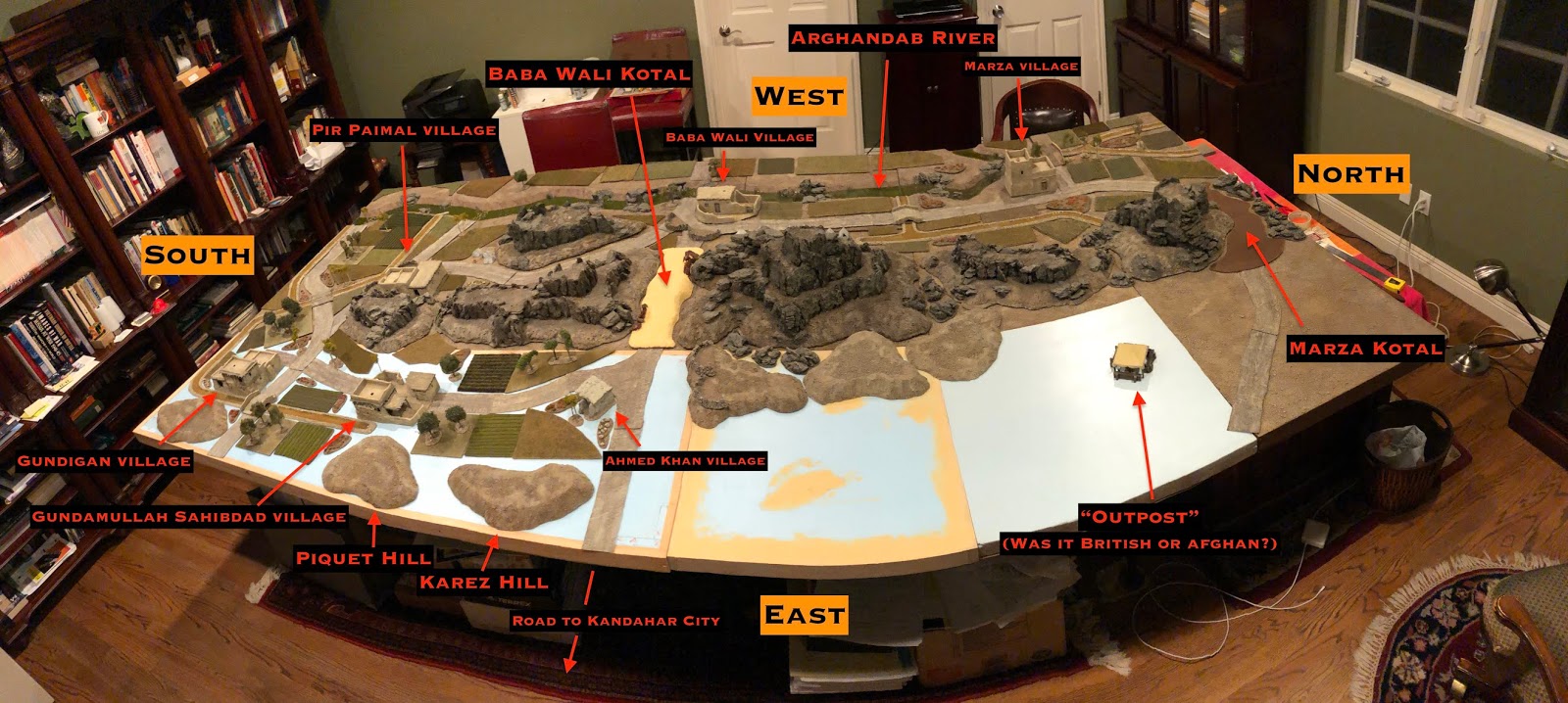
NOTE: This is the map with a spot in the “open field” between the Baba Wali and Murza Kotals labelled “OUTPOST”. My big question is: was this a British outpost established before Ayub Khan’s army surrounded and besieged the city, at which point it was abandoned… OR was it an Afghan outpost, established when Ayuub’s army abandoned the siege and occupied their defensive line to the West? Or perhaps something completely different, like a newly established British outpost set up by General Roberts immediately after his arrival at Kandahar? In all the descriptions of the battle in primary and secondary sources, I’ve never seen a single mention of this “outpost” — but it’s there, on this map, which is the most detailed and accurate of all the maps in secondary source history books, and looks the closest to the original source for these later, less detailed maps, which is the “Official History” map at the ends of this group of photos. Needless to say, if anyone reading this post has additional information RE: this “OUTPOST” feature, I would LOVE to hear it!
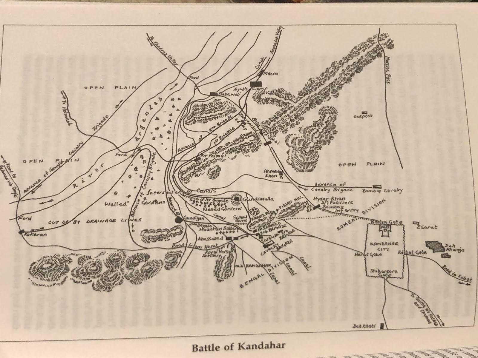
Map of the ENVIRONS OF KANDAHAR from the “OFFICIAL HISTORY”:

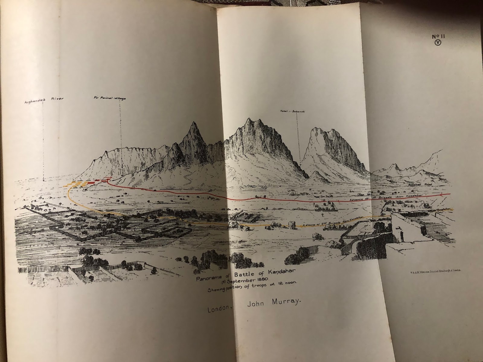
Panorama of the battle from the OFFICIAL HISTORY – FULL VIEW:
Panorama of the battle from the OFFICIAL HISTORY – CU LEFT SECTION:

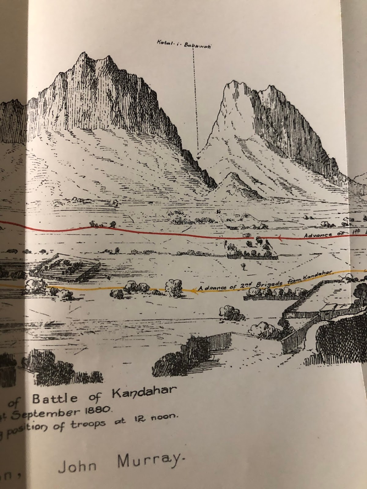
Panorama of the battle from OFFICIAL HISTORY – CU CENTER SECTION:
Panorama of the battle from the OFFICIAL HISTORY – CU RIGHT SECTION:

And finally, what I believe to be the ultimate map of the battle of Kandahar…
FULL BLOWN MAP OF THE BATTLE FROM THE OFFICIAL HISTORY:

Based on all of the above — with particular attention paid to the above map in the “Official History” I adjusted the layout of the table.
One big adjustment was deciding (with some encouragement my buddy Jeff “Sgt. Guinness” Baumal!) to EXTEND the North end of the table (in reality it’s more the North-Eastern end) in order to include the MURZA KOTAL. The additional 2′ length also allowed me to adjust the relative sizes of the various hills and the distances between various key pieces of terrain to bring them into better accord with the distances on the Official History map, thereby making them — I hope — more accurate.
After resetting the terrain features I laid out crop-fields, orchards, poppies, and trees from my old Maiwand and Charasiab layouts. I’m pretty happy with how its looking, though obviously there’s still a lot of work to be done, just getting the still blue foam terrain boards into shape. But that is work for another day. For now I will simply enjoy the progress made, and hope you do as well!
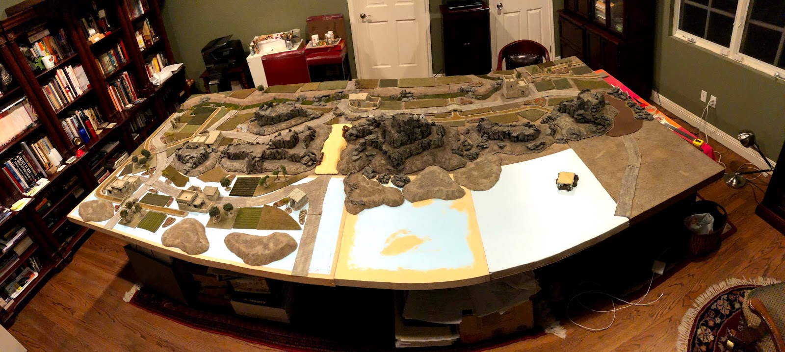
REVAMPED TABLE LAYOUT as seen
from British lines (view from the South-East):
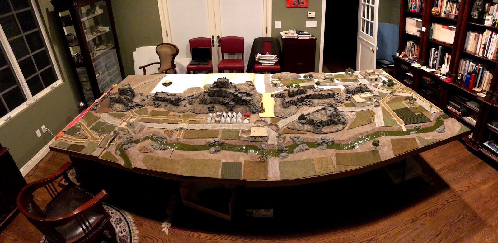
REVAMPED TABLE LAYOUT as seen
from Afghan lines (view from the North-West):
BRITISH VIEW w/terrain featured labelled:
AFGHAN VIEW w/terrain features labelled:

I hope everyone reading this and all of those you love and care for are staying safe and healthy in these challenging times. And as I’ve said before and will say again, if you work in the Medical profession, THANK YOU for what you are doing, and I hope and pray you manage to stay safe and remain healthy while doing it; and if you are a police officer, firefighter or EMT, or drive a truck, train or aircraft, or work on a farm, or at a pharmacy, supermarket, take-out restaurant, gas station, hardware store, lumberyard, plumbing store, gun store, supply warehouse, or similar essential place of business to keep our society functioning, THANK YOU for going to work and doing your job in the face of inherent danger, thereby enabling the rest of us to carry on.